How National Geographic’s 1967–1971 Ocean Floor Map Changed the Way We See Earth Forever
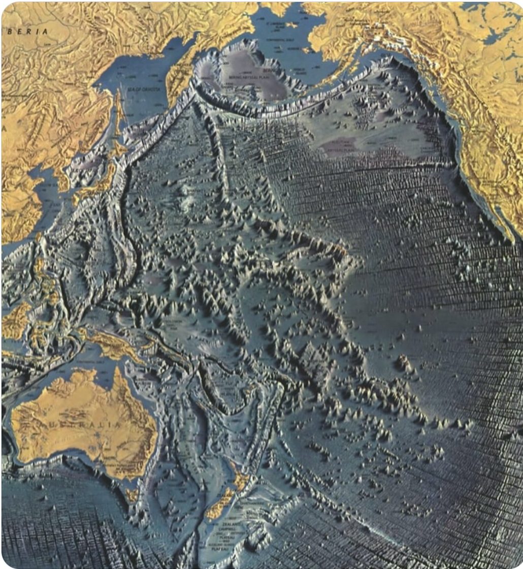
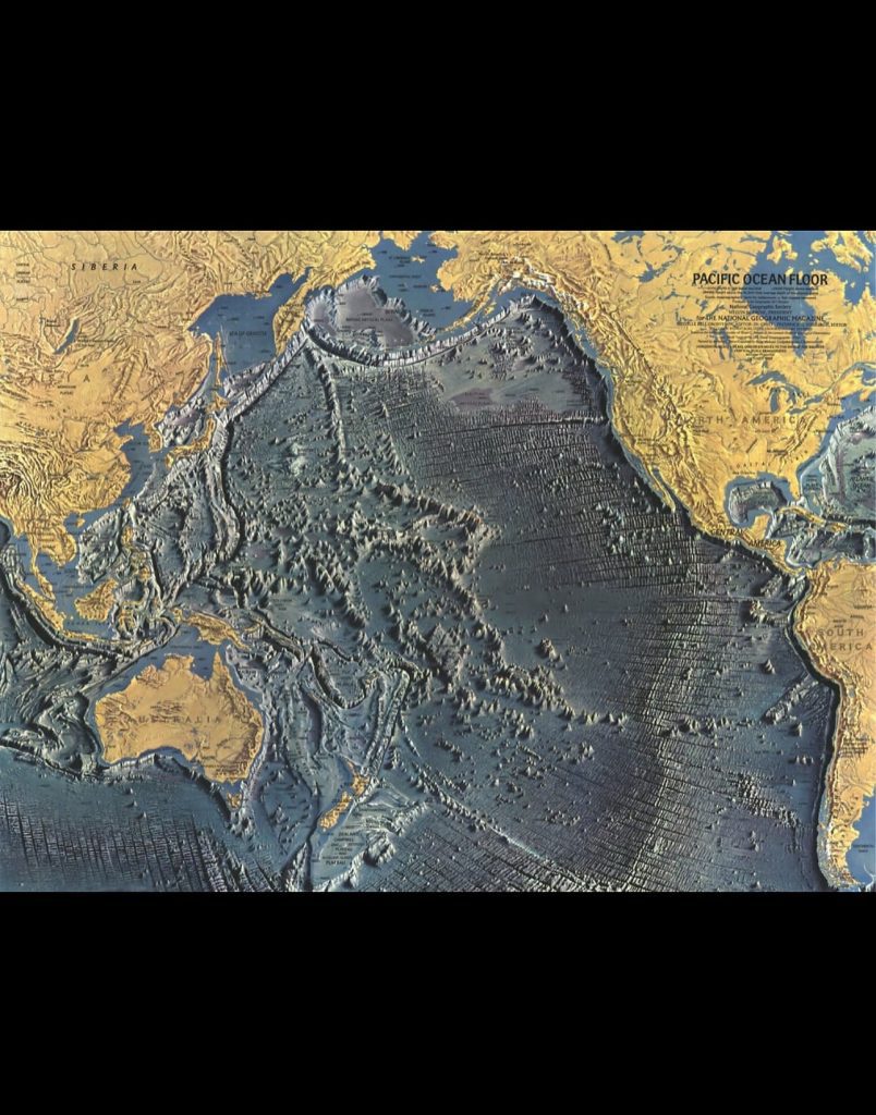
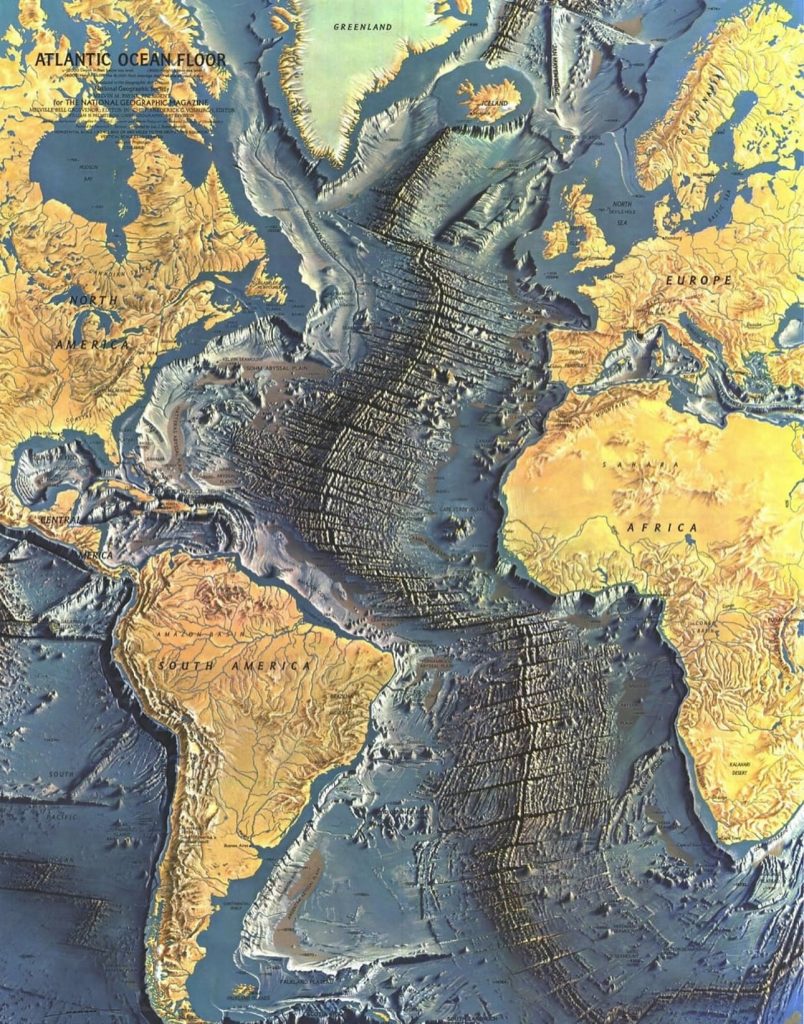
There are moments in history when a single image changes the way we look at the world. For me, one of the most mind-blowing examples isn’t a photograph of a galaxy or a new planet, but a map of something far closer to home—our own oceans. In the late 1960s and early 1970s, National Geographic published a groundbreaking map of the ocean floors, created through painstaking work that combined art, science, and exploration. Looking at that map today, with its ridges, trenches, and vast undersea mountains, feels like gazing at another planet hiding right beneath our feet.
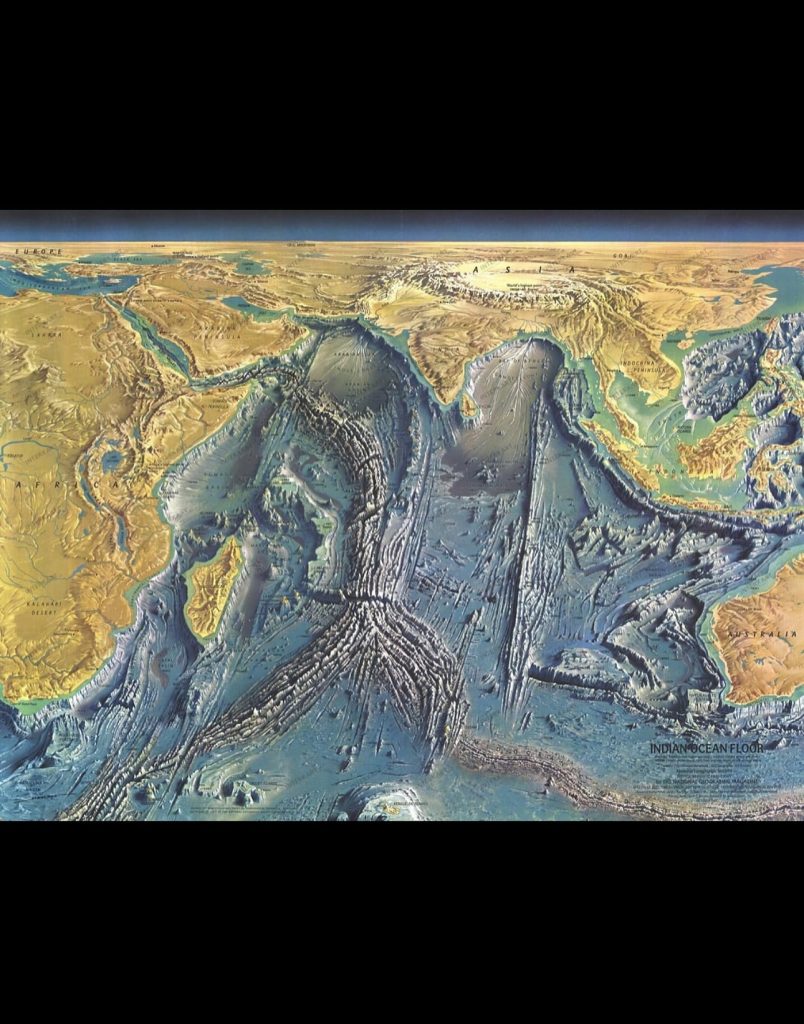
Before these maps were widely shared, most people imagined the seafloor as a relatively flat, featureless expanse. After all, how could you visualize something no one had truly seen? Sonar technology was still developing, and while researchers had some sense of ridges and depths, there wasn’t a full picture that ordinary people could grasp. Then came Bruce Heezen and Marie Tharp, two pioneers in oceanography who dedicated their careers to charting the seafloor. Tharp, in particular, played an incredible role as a woman in science at a time when the field was overwhelmingly male. Her careful interpretation of sonar data revealed an astonishing truth: the seafloor was alive with dramatic landscapes—mountains taller than the Alps, valleys deeper than the Grand Canyon, and trenches plunging to unimaginable depths.
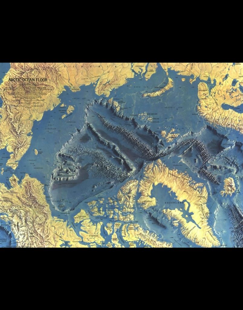
National Geographic turned their research into something breathtaking. Published between 1967 and 1971, the map was more than just data on paper—it was a visual masterpiece. Using bold colors and 3D-style shading, it transformed abstract numbers into an image that ordinary people could not only understand but feel. The ocean floor was no longer invisible. It was revealed as a rugged, dynamic world with peaks, cliffs, and endless ridges that stretched across entire oceans like scars marking the Earth’s skin. For many, this was the first time the concept of plate tectonics really came to life. You could literally see the Mid-Atlantic Ridge snaking down the globe, a clear sign that the Earth’s crust was shifting and reshaping itself over millions of years.
The timing couldn’t have been more perfect. In the 1960s, humanity was reaching for the stars with the space race, but at the same time, we were just beginning to understand our own planet’s most mysterious frontier. When people opened their copies of National Geographic and saw these maps, it must have been like discovering an alien world. Suddenly, the ocean wasn’t just water covering most of the Earth—it was a hidden realm, complete with mountains, volcanoes, and valleys that rivaled anything found on land.
Even today, with satellites and high-tech imaging, the map holds an almost magical power. There’s something about the artistry and detail that feels more personal than a digital scan. It reminds us that science is not just about numbers; it’s about imagination, about piecing together hidden truths from fragments, and about showing people a world they never thought existed.
I think what makes this so powerful is how it shifts our perspective. We often look up at the sky and wonder about other planets, but this map reminds us that we live on one of the most extraordinary planets of all. Beneath the surface of our oceans lies a landscape so vast and so dramatic that it humbles you. The idea that this was only revealed to the public just a few decades ago is mind-blowing. It shows how much of our own world is still waiting to be discovered and how curiosity and perseverance can literally redraw the way we see the Earth.
When I look at that map, I feel a mix of awe and gratitude. Awe at the sheer scale and beauty of the ocean floor, and gratitude for the scientists and artists who brought it to light. They gave us a gift—not just knowledge, but wonder. And in a way, that’s the greatest discovery of all.

Daniel Reed is a curious mind with a passion for breaking down how the world works. With a background in mechanical engineering and digital media, he turns complex ideas into easy-to-understand articles that entertain and inform. From vintage tools and modern tech to viral internet debates and life hacks, Daniel is always on the hunt for the “why” behind the everyday. His goal is simple: make learning feel like scrolling through your favorite feed — addictive, surprising, and fun.